Mt Leura & Mt Sugarloaf Reserves Mt Leura & Mt Sugarloaf Management Committee, Corangamite Shire, Camperdown, Victoria, Australia
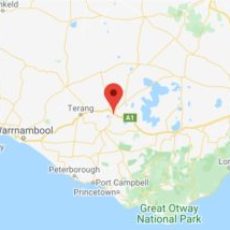
Volcanic Plains – Camperdown, South West Victoria, Australia.
Mount Leura & Mount Sugarloaf are part of a large volcanic complex known as the Leura Maar which was formed more than 20,000 years ago by a series of major volcanic eruptions.
Since 1995, community involvement on the Reserve has resulted in major conservation and revegetation activities, including planting thousands of indigenous trees, grasses and herbs, construction of paths, information displays and shelters.
Located in the third-largest volcanic plain in the world, the summit of Mt Leura affords magnificent views of the districts many volcanic cones. Take the time to explore the amazing natural beauty of the reserve − you never know what you might find!
Conservation, community, cultural heritage… discover the unique geology, flora, fauna, and history of the reserves.
What´s On? Connect with us on Facebook
Key successes & achievements.
You can read the updated Mt Leura and Mt Sugarloaf Management Plan 2019-2023 by clicking this link.
Management Plan
Mt Leura & Mt Sugarloaf
Discover History
Learn more about project progress.
Walking Trails
Brochures available at shelters.
To get involved email Friends of Mt Leura: foml [at] mtleura.org.au or use our contact form.
VVP Indigenous Wildflower Garden
Lower Shelter Flora Display Garden
Silver Banksia Trail Seed Orchard Planting
Volcanic Plains Plantings
Reserve Wildlife
Brochures available at shelters.
ATTRACTIONS
RESERVE & PROJECT
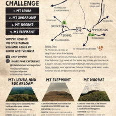
FOUR PEAKS CHALLENGE
Camperdown Victoria
Discover more about our region, including where to stay: https://visitgreatoceanroad.org.au/visit12apostles/
Search Mt Leura at see what you find: https://visitgreatoceanroad.org.au/search/?_sf_s=mt%20leura
Walking Trails: https://visitgreatoceanroad.org.au/volcaniclakesandplains/walking-trails-of-mt-leura-mt-sugarloaf-reserves/
Take a virtual run up Mt Leura & Mt Sugarloaf! https://visitgreatoceanroad.org.au/volcaniclakesandplains/local-attractions/mount-leura-twin-peaks-shortened-loops-5-1km/


